
New map aims to help users navigate more than 1,100 Mat-Su trails
The interactive trail map is hosted on the Mat-Su borough's website.
What you need to know:
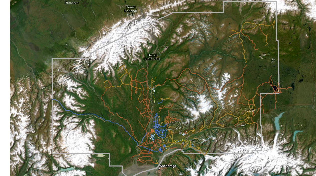
- The Matanuska-Susitna Borough has released a new interactive map featuring nearly 1,200 trails spanning more than 3,100 miles across the region. The map includes both motorized and nonmotorized trails and is aimed at enhancing year-round outdoor recreation access for residents and visitors.
- Created by the borough’s GIS team over several years, the map integrates data from various sources and will be continuously updated based on community feedback. Officials are also planning additional features, such as filters for seasonal trails.
- While the map aims to be comprehensive, some trails that cross private property are excluded. A disclaimer notes that listing a trail does not guarantee legal or safe public access.
PALMER — A new interactive trail map is designed to give Mat-Su residents a first-ever comprehensive view of recreation options on nearly 1,200 trails throughout the region.
Created by Matanuska-Susitna Borough officials and available for use or download on the borough’s website, the map includes 3,173 miles of motorized and nonmotorized trails, with details such as length and typical use. It features both borough and state trails.
Borough officials said they created the map to capture as many public trails as possible, including little-known destinations and winter-only options, and to encourage residents to get outside year-round and help visitors access recreation.
“Our job is to always maximize the return on investment for taxpayer dollars, but then we’re also always trying to enhance, diversify and increase the opportunities for outdoor and other recreation here in the Valley,” said Jillian Morrissey, the Mat-Su Borough community development director.
The new map, which was first released last month, is different from previous efforts because of the number of included trails and because it is not limited to borough-owned land, she said.
Creating the map was a yearslong project by the borough’s Geographic Information Systems staff, said GIS specialist Heidi Whipple. The team used a variety of data sources to create the map and plans to actively update it based on feedback.
“As I’ve worked with this data over a number of years, I’ve just tried to glean the best available knowledge,” she said.
For example, the map identifies a trail’s typical use and includes whether it is motorized. After adding nonmotorized information to one trail in Hatcher Pass, state officials reached out to let Whipple know the area is also a snowmachine corridor, and she updated the map accordingly, she said.
While residents will likely discover new-to-them trails, they may also notice a few popular spots missing, Morrissey said. For example, officials excluded several trails in the Meadow Lakes area because large portions of them cross private property, she said. A disclaimer on the map also notes that inclusion does not mean the borough certifies the land as public.
“Us putting out a map that has this trail doesn’t mean that we’re verifying that this is safe and legal to access,” she said. “We’re just saying that’s a known track that’s there.”
Officials plan to continue updating the data over time, including adding a filter that allows users to display only winter or summer trails, Whipple said. The information is also being used to update some of the borough’s printed trail maps to make locations more accessible to in-person visitors.
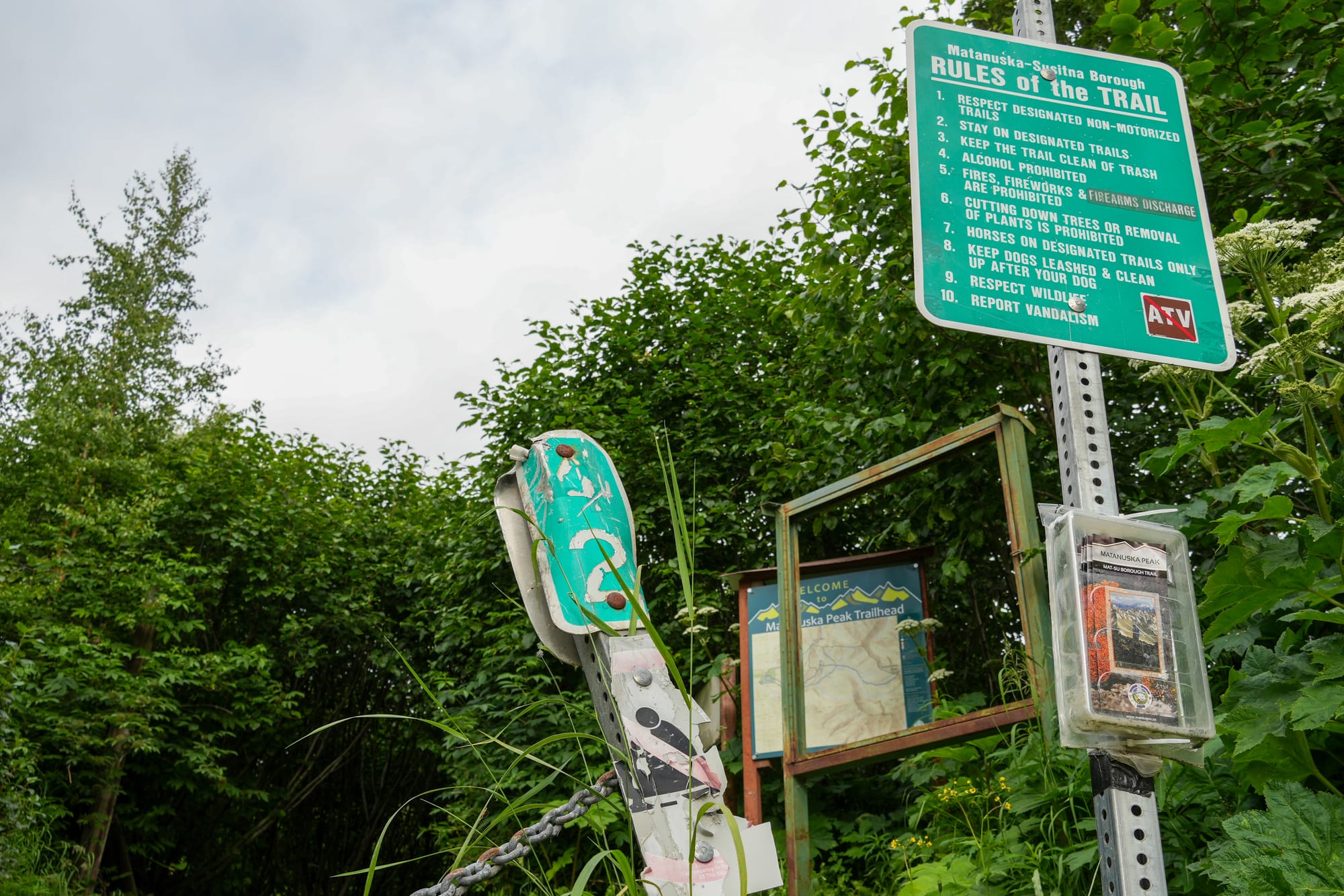
The map project dovetails with a series of other park updates designed to improve usability, Morrissey said. Trailhead map signs at popular spots like the Bodenburg Butte and Matanuska Peak have already received updates, and officials plan to install clearer on-trail signage to help users navigate the confusing greenbelt network, which includes Crevasse Moraine and Matanuska Lake State Recreation Area.
Officials also plan to use the updated data to introduce a map that provides near-real-time updates of trail grooming in the winter. Like a similar tool used by the borough’s snowplow operators, the grooming map will show the latest winter trail maintenance information across the region, Morrissey said.
-- Contact Amy Bushatz at contact@matsusentinel.com