
Borough installs hundreds of new signs to make Mat-Su trail network less confusing
The project repalced about 350 aging trail signs.
What you need to know:
- The Matanuska-Susitna Borough has replaced about 350 aging trail signs throughout the nearly 3,000-acre Matanuska Greenbelt with new trail maps, location markers and directional arrows to help visitors navigate the trail system.
- The updated signs reflect the latest trail reroutes and closures and they include all officially designated trails. They are intended to reduce confusion in the Greenbelt's more than 30-mile network of interconnected trails. The signs do not include trails that are not officially designated by the area's landowners.
- The $38,000 project was funded through a grant from the Mat-Su Trails and Parks Foundation and completed through a partnership among borough, state and University of Alaska officials after years of coordination challenges.
- Short on time but need the local news scoop? Get free weekly news in your inbox for Mat-Su, from Mat-Su.
PALMER – Navigating the twisting trails of the nearly 3,000-acre Matanuska Greenbelt could be a little less confusing after Mat-Su Borough officials installed hundreds of new maps and directional signs this summer.
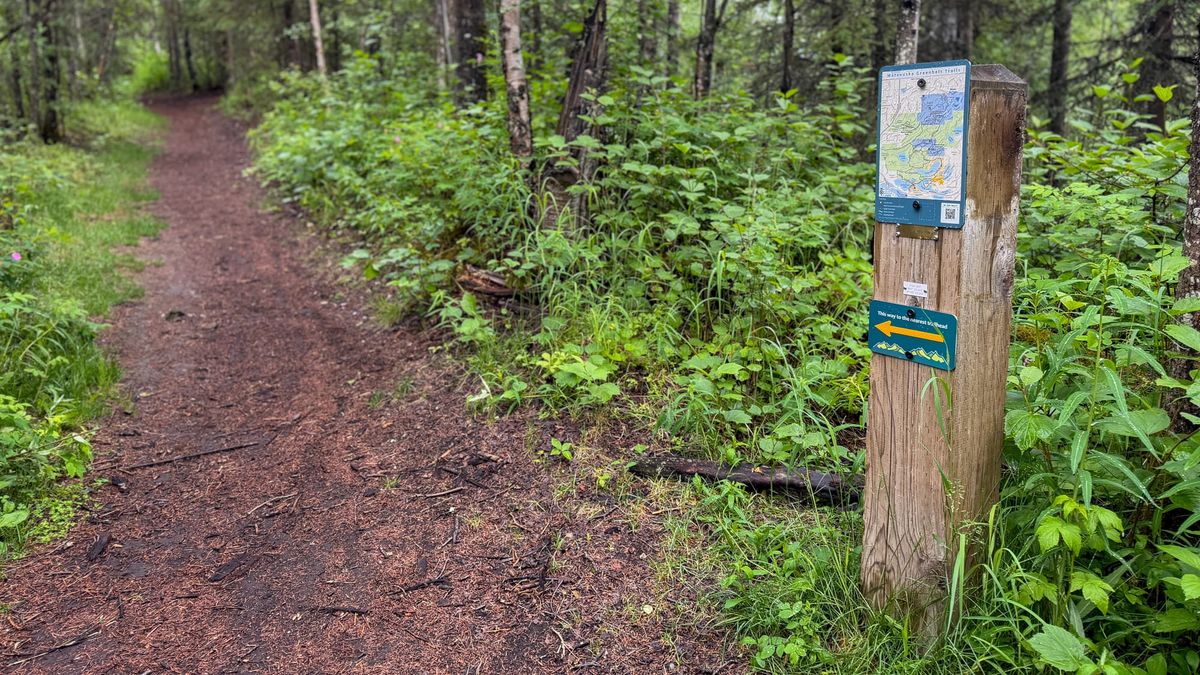
The project, which wrapped up earlier this month, replaced about 350 brown-and-white trail name signs originally posted about 16 years ago with colorful trail maps paired with "You Are Here" markers. Some signposts also include new arrows pointing the way to the nearest trailhead.
The Greenbelt's more than 30-mile network of nonmotorized trails winds and loops across 2,800 acres from near the intersection of Trunk Road and the Glenn Highway east to just outside Palmer city limits.
The area connects broad University of Alaska system-owned farmland with narrow, rooty paths behind Mat-Su College, the wooded trails of Matanuska Lake State Park, and the rolling grassways and packed dirt trails on borough land designated for the landfill and used for the Cravasse-Morraine Trail System.
The Greenbelt hosts the longest interconnected trail system in Mat-Su's core area. But the labyrinth also makes it easy for users to get turned around and accidentally end up in the wrong place, officials said. A decade of trail reroutes and closures tied to landfill expansion and new experiments at the University of Alaska Fairbanks farm also left some signs inaccurate, adding to the confusion.
"One of the common things I've heard in my time working with the borough is a lot of people complain about getting turned around and lost," said Alan McClain, a borough trails specialist who has worked for the borough for more than a decade. "As a trail user before I got this job, I had been lost out there as well, so I understand the pain."
The new map signs include trails that previously appeared on some maps but not others, such as the miles-long thoroughfare known as the Long Lake Connector.
They do not include trails that the landowner has not officially recognized, such as the heavily used Rooty Trail, a nearly 2-mile stretch that connects sections of Cravasse-Morraine. They also do not include trails in an area in the southeast section of the Greenbelt known as the Machetanz Wilderness, which the Machetanz family donated to the University of Alaska in the 1980s and is to remain undeveloped until at least the 2030s under the gift agreement, according to borough documents.
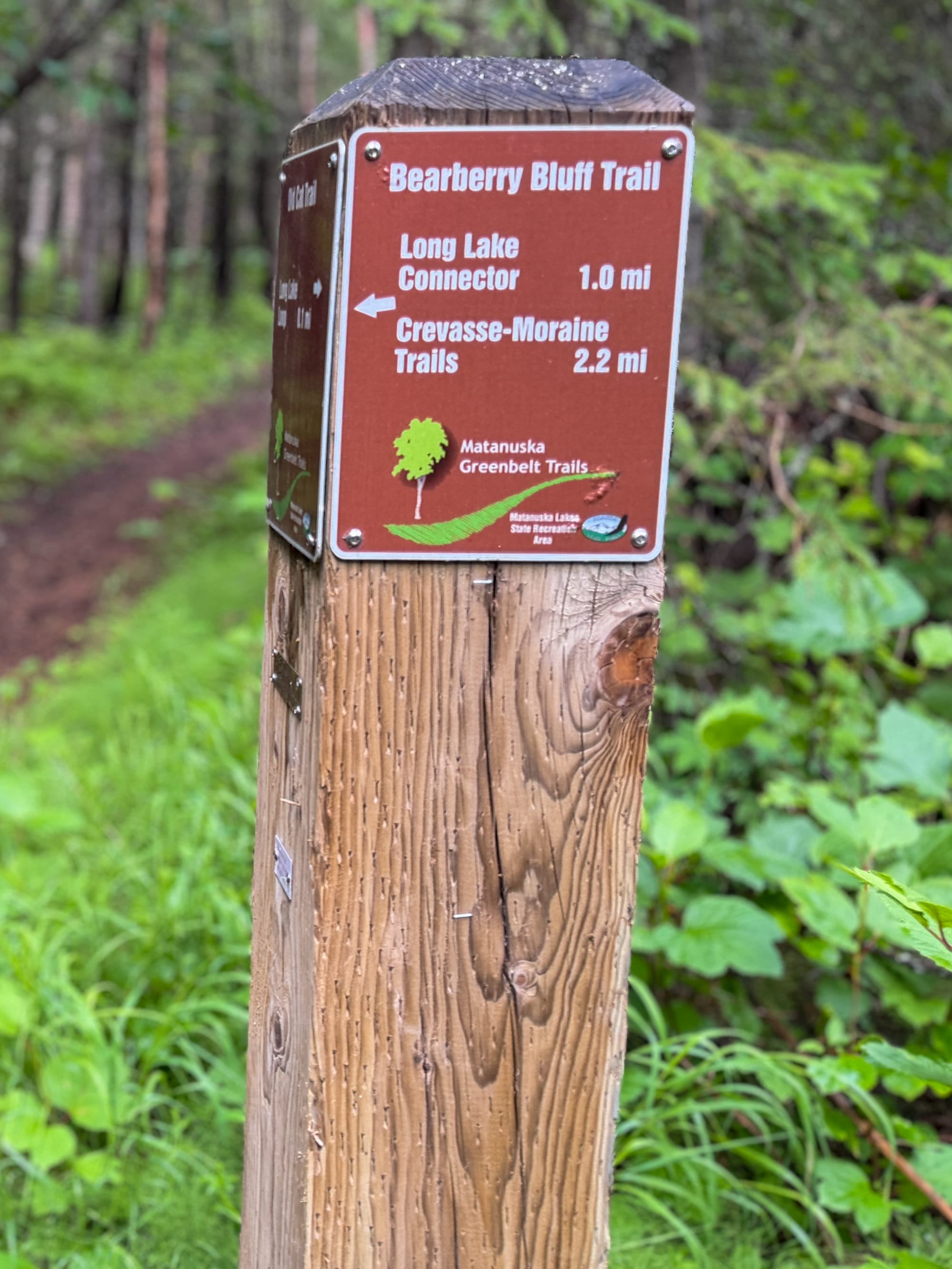
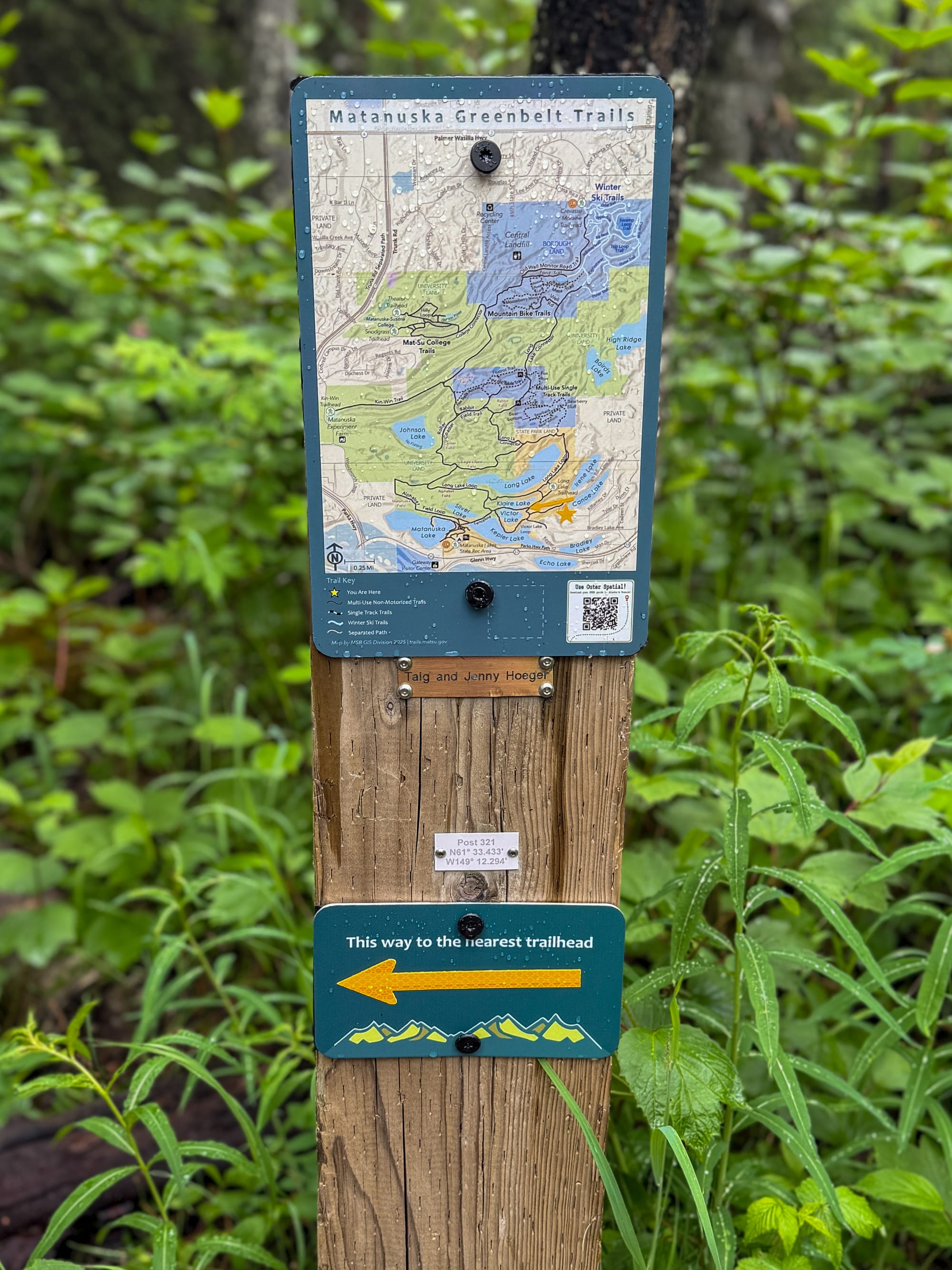
The old-style brown and white direciton signs (left) within the Matanuska Greenbelt were replaced with map and "nearest traihead" signs in June, 2026 as part of an effort to improve navigation through the twisting maze of trails. (Amy Bushatz/Mat-Su Sentinel)
The signage update kept in place a series of small memorial plaques first attached to many of the signposts when they were installed. Longitude and latitude markers on some poles also remain intact.
Matanuska-Susitna Borough officials led the update effort with funding from a $38,000 grant from the Mat-Su Trails and Parks Foundation, borough officials said.
Managing the Greenbelt across multiple landowners has long been an organizational challenge complicated by funding constraints and competing priorities, according to officials and borough documents. An initial coordinated trail plan "got lost in communications" between 2012 and 2014, according to a 2017 borough summary, which also describes a series of related and confusing meetings where stakeholders "didn't realize what meeting they were in sometimes."
While the project was a long time coming, it moved quickly once it had the attention of motivated staff members, said Alaska State Parks spokesperson Wendy Sailors.
"It just takes two people that really, really care," she said.
-- Contact Amy Bushatz at contact@matsusentinel.com